 |
| images from Geograph |
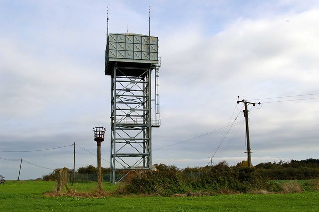
A former Braithwaite water tower near Allhallows, Medway, England once owned by Southern Water was converted in September 2008 into a radar station by the Port of London Authority to monitor ship movements on the Thames. The Yantlet Line which marks the downstream limit of the PLA area lies 4 km to the east.
This re-version is a variation of the Tilbury radar tower disguised during WWII as a water tower.
This re-version is a variation of the Tilbury radar tower disguised during WWII as a water tower.
Information Britain says:
Allhallows is a village and civil parish on the Hoo Peninsula in Kent, under the unitary authority of Medway Council. The Hoo Peninsula is a jutt of land above Rochester, sandwiched between the Medway and the Thames and divided from the Isle of Grain by the Yantlett Creek. Allhallows village is in two parts: the ancient Hoo All Hallows and the 20th century holiday colony Allhallows-on-Sea. Hoo All Hallows is clustered round the parish church of All Saints. All Saints church dates from the 12th century and is the only Grade I listed building on the Hoo peninsula. The modern holiday village of Allhallows-on-Sea lies to the north of the village and was developed by Southern Railways in the 1930s. Their original planned development never took place because of World War II, but there is a now a Haven holiday park and some residential properties on the estuary shore. The station was demolished in 1961 and sold for use as a holiday caravan park. There is a listed railway water tower situated among the caravans. The area is popular with bird watchers. Other leisure activities include a 9 hole golf course and The Cross Park Country Park. There are a couple of pubs, The Rose and Crown Inn and The British Pilot.

No comments:
Post a Comment